🚨⛈️ SEVERE THUNDERSTORM WATCH ISSUED ⚠️
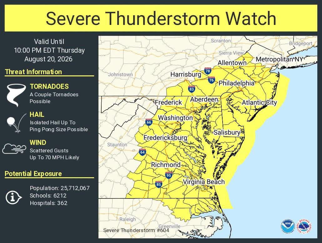
A Severe Thunderstorm Watch is in effect for the region through this evening. Residents should prepare for potential flash flooding, large hail, isolated tornadoes, and damaging wind gusts reaching up to 80 miles per hour.
A Severe Thunderstorm Watch has been issued as atmospheric conditions become increasingly favorable for scattered severe thunderstorms this afternoon and evening.
🌤️ Sunshine breaking out across the region, combined with the northward movement of a warm front, is helping fuel additional instability. Strong wind shear is also present, meaning some storms could develop significant rotation.
📍 The greatest threat appears to be across the western portions of our viewing area, although severe weather cannot be ruled out elsewhere.
🌪️ Potential threats include: • Torrential rainfall 🌧️ • Flash flooding 🌊 • Dime to quarter-sized hail 🧊 • Damaging wind gusts of 60–80 MPH 💨 • Isolated tornadoes 🌪️
Our team will continue monitoring radar and weather developments throughout the afternoon and evening. Updates will be posted if conditions become more concerning.
⚠️ WATCH vs. WARNING:
🟡 WATCH: Conditions are favorable for severe weather. No immediate action is required, but residents should stay weather-aware and have a way to receive alerts.
🔴 WARNING: Severe weather is occurring or imminent, typically based on radar indications or reports from trained weather spotters. Take shelter immediately.
Stay weather-aware and have a safe afternoon! ⛈️